
❄️ 7 Easy & Beautiful Winter Hikes in Litchfield County, CT (Maps + Tips)
- Amber in New England

- Jan 9, 2024
- 6 min read
Updated: Jan 25
Litchfield County offers some of the most scenic winter hikes in Connecticut. Perfect for beginners, families, or anyone wanting an easy snowy adventure without losing the views.
Whether you’re exploring CT winter hikes or looking for beginner-friendly winter trails in Litchfield County, these seven hikes are ideal.

Many of these trails also show up in my list of short hikes in Northwest Connecticut that work year-round with the right conditions.
Welcome to Litchfield County, CT
Litchfield County is a winter paradise! Rolling hills, charming towns like Litchfield and Washington, and classic New England vibes. The towns are warm and the trails offer over 200 miles of hiking.
Essential Winter Hike Prep
Even though these trails are easy hikes in Litchfield County, preparing for them requires a winter-specific approach. The key to an enjoyable winter hike is proper layering and traction.
Essential Winter Prep Checklist | Action Item |
Layering | Ditch the cotton! Layer up with a base, mid, and outer layer. (See my full guide on How to Layer for a Day Hike: The Essential 3-Layer System). |
Footwear | Wear tall, wool winter socks. Step into insulated winter hiking boots with ankle support to combat temperatures that can drop below 15 degrees. |
Traction | Toss in a pair of hiking micro-spikes if the trails are icy. For deeper snow-covered paths, opt for snowshoes. |
Backpack | Assemble the perfect day pack stocked with all the essentials. (Use my Day Hiking Essentials Checklist: What to Pack for New England & Beyond). |
Whether you're a seasoned hiker or just eager to explore, these CT winter hikes are ready and waiting!
The 7 Best Easy Winter Hikes in Litchfield County
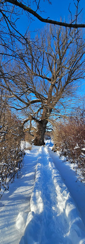
1. Little Pond Boardwalk Trail — Easy Winter Hike in Litchfield, CT
The Vibe: A lollipop trail that goes around Little Pond, part of the White Memorial Foundation in Litchfield.
Why It's Easy: This trail is about 1.2 miles long, mostly on an elevated boardwalk that barely gains elevation.
Winter Scene: During the winter, the trail is quiet. You can hear birds chirping as you make your way around the loop. A perfect spot for peaceful snowy scenes.
GPS Directions [GPS Link]
Parking: Parking lot right off of the main road, large enough for around 20+ cars. If this lot is full, there is another trailhead across the street with a lot.


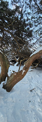
2. Topsmead State Forest — Scenic & Beginner-Friendly Winter Hike in Litchfield, CT
The Vibe: Perfect for a laid-back winter hike or an easy stroll. It’s like a mini-adventure with a scenic walk through historic grounds.
Why It's Easy: Spread across 16 acres, you can wander through the woods, chill by the pond, and check out the grounds of a beautiful English Tudor style house.
Winter Scene: The grounds covered in snow offer fantastic photo opportunities.
GPS Directions [GPS Link]
Parking: Once you pull up the driveway off the main road, there will be a parking lot on the right for around 20+ cars.


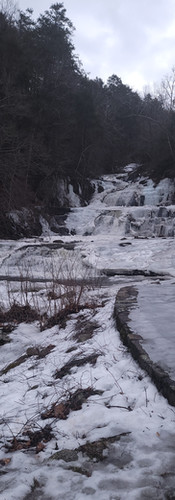
3. Kent Falls State Park — Winter Waterfall Hike in Kent, CT
The Vibe: If you are looking for a dramatic winter waterfall without a long hike, this is the place.
Why It's Easy: The jewel of the region, Kent Falls boasts a series of cascading waterfalls. Only a few icy steps from the parking lot, you can take in this scene.
The Walk: The trail leads you up a set of stairs and paths, winding through wooded areas and providing a few viewing points. A must-see!
GPS Directions [GPS Link]
Parking: There is a main parking lot off of the main route, very easy and visible. Parking for 40+ cars.


4. Campbell Falls State Park — Short Winter Hike on the CT/MA Border
The Vibe: Tucked in the corner of Connecticut and straddling the Massachusetts border, the 100-foot waterfall is surrounded by forests, making for a peaceful experience.
Why It's Easy: The trail leading to the falls from the main parking area in Southfield, MA, is short but rewarding.
Pro Tip: Be warned, in the winter this trail can be icy. To add some mileage, opt to park at the trailhead off Spaulding Road in Norfolk and hike in about 0.5 miles to the falls.
GPS Directions [GPS Link]
Parking: There are two parking lots for this park, for the hiking trail park at the Spaulding Road lot. For the shorter trail park at the smaller Campbell Falls Road lot.


5. Orenaug Park — Easy Winter Hike with Fire Tower Views in Woodbury, CT
The Vibe: The perfect opportunity to visit a fire tower without putting in the miles.
Why It's Easy: Park on Park Road by the pond and take the Fire Trail between the two stone pillars. This trail is easy and direct, making it about 1.1 miles out and back.
The Reward: Once at the end, you're greeted by a 520 foot fire tower, where you get a 360 degree view of Pomperaug Valley. You also hike to two other viewing points looking out over the town.
GPS Directions [GPS Link]
Parking: There is no parking lot for this trail. You will need to park on the Park Road pull-off next to Crystal Lake. About 4 cars can fit.


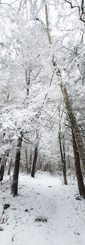
6. Fox Brook Trail System — Customizable Winter Hikes in Goshen, CT
The Vibe: An awesome, customizable adventure by the Goshen Land Trust.These trails will lead you through the woods, across a couple of bridges, and alongside the river, a perfect playground to spot wildlife.
Why It's Easy: This is a three-part system of easy trails:
John Ross Trail: About 3.6 miles out and back.
Richard Kobylenski Wildlife Area: Around 2 miles out and back.
Fox Brook Preserve: A quick 0.7-mile escape.
GPS Directions [GPS Link]
Parking: Parking for Fox Brook Preserve is tight; it's better to kick off from Pie Hill Road or East Street South for a longer hike. Be careful crossing the busy Route 4. There are small lots or street parking for John Ross and Richard Kobylenski on Pie Hill Road and East Street South.


7. Barbour Woods — Flexible Winter Hikes in Norfolk, CT
The Vibe: A series of easy trails throughout the forest and meadows. Look for scenic areas like the old stone arch bridge and views of Haystack Mountain across the street.
Why It's Easy: With so many trails, you can create your own hike, making it as long or short as you wish.
GPS Directions [GPS Link]
Parking: The main parking area is off of Lovers Lane. There is room for 15+ cars.


Frequently Asked Questions: Easy Winter Hikes in Litchfield County, CT
Q1: What are the easiest winter hikes in Litchfield County, CT?
A: Some of the easiest winter hikes include Little Pond Boardwalk Trail and Topsmead State Forest. These trails are mostly flat, well-marked, and beginner-friendly, making them perfect for snowy walks and short adventures.
Q2: Are these Litchfield County winter hikes good for beginners?
A: Yes! All 7 hikes featured in this guide are beginner-friendly. Trails like Kent Falls and Fox Brook Trail System are short, scenic, and accessible even in winter, requiring minimal experience.
Q3: Can I hike these trails with my dog in winter?
A: All of these trails are dog-friendly, but always check individual park rules. Be sure to bring a leash, dog booties for icy paths, and keep your pet warm during snowy hikes.
Q4: What should I wear for winter hikes in Litchfield County?
A: Layering is key! Wear a moisture-wicking base layer, an insulating mid-layer, and a waterproof outer layer. Add wool socks, insulated boots, and traction gear like micro-spikes or snowshoes depending on conditions.
Q5: Do I need special gear for icy trails?
A: Yes, even easy winter hikes can get slippery. Micro-spikes or crampons are recommended for icy sections, and snowshoes are ideal for deeper snow. Trekking poles can also help with stability.
Q6: How long are these winter hikes?
A: The trails range from short loops like Little Pond Boardwalk (1.2 miles) to slightly longer options like John Ross Trail (3.6 miles). Most hikes can be completed in 1–2 hours, making them perfect for a half-day adventure.
Q7: Where can I park for these Litchfield County winter hikes?
A: Each trail has specific parking areas. For example, Kent Falls has a lot near the main falls entrance, Orenaug Park has parking on Park Road, and Fox Brook Trail System has several access points. Check local signage and trailhead info before visiting.
Q8: Which hike has the best winter views?
A: For beautiful winter views, Kent Falls and Barbour Woods offer dramatic snowy waterfalls and forest scenery. Orenaug Park’s fire tower also gives panoramic views of the Pomperaug Valley blanketed in snow.
Q9: Can these trails be hiked in deep snow?
A: Yes, with proper gear. Snowshoes are recommended for deeper snow, especially in uphill trails like at Orenaug Park. Trails like Little Pond Boardwalk are mostly cleared or elevated, so they are easier in heavier snow.
Q10: Are these trails safe for solo winter hikers?
A: They are generally safe, but always take precautions: check the weather, bring a fully charged phone, wear bright layers, and let someone know your hiking plan. Stick to well-marked trails for the best winter safety.
When you are trying to plan your next winter hike, remember: it's not about the distance, it's about taking it easy and having a good time outdoors! Hope you enjoy your next winter adventure in Litchfield County.
Which winter hike are you planning to explore first? Check out my Easy Hikes in Northwest Connecticut guide for more year-round trails!


Comments